Thursday, February 7, 2013

Mount Pulag, the second highest- second to me.


Being born in Baguio City, I always wanted to one day climb the highest mountain around here.  Unfortunately, the opportunity never presented itself…until last January 2013.  Due to unforeseen circumstances, I was given time off from work and had enough time to finally realize my dream of climbing the highest mountain in Luzon, Mt. Pulag.

The timing couldn’t have been better! Most of the old troops are available, and we often talked about one day conquering this mighty highland.  So I decided to take the next available trip up to Baguio City and meet up with the gang, saddle up, and get it started!

We packed up our gears, tents, clothing, and food…lots of food- from canned goods to bread to water.  This is our first time climbing together, we wanted to be organized and ready- but nothing could prepare us from what was in stored for us.

We went early to the “Slaughter House” bus station for the ride to Bokod but was informed that the bus would be leaving 10:00 am which was too late for us.  There are vans available which can leave earlier and the fare is around P120 so we took one after a quick breakfast.  For those who plan to eat near the bus station and are under a tight budget, ask and check the prices first.  We made the wrong choice of eating at what we thought would be a regular carinderia but the prices reflected otherwise.

Our van left before 9AM and took the Ambuklao road.  We had the chance to take a quick stop at the Ambuklao dam and took some pictures.  I plan the next time I come here, I should spend more time at the dam.  The structure amazed me, and come to think, this is the first time I’ve seen one.  We continued our way and stopped over at Jang Jang eatery at Bangao, Ambuklao for a cup of coffee since we just had breakfast.  You can have a nice view at the back of the eatery while you sip on your coffee or check the fresh tilapias and giant karpas for sale nearby.
Ambuklao Dam

Jang Jang Eatery
Karpa Fish

Behind Jang Jang Eatery


We reached Ambangeg before lunch where we registered and had a quick orientation at the DENR Protected Area Office.  After we watched a video presentation, the more we were eager to reach the peak of this “playground of the gods”.  We bought dressed chicken and some veggies before we started walking again.  I love the highland goodies; one kilo of tomato is only P20!  That’s gold back in Manila!
DENR Orientation
DENR Office

Start walking!


OK, the plan was to walk all the way to the ranger station and take the Ambangeg trail.  Based on blogs we’ve read and from asking the locals, they said it should only take 3 hours to get to the station.  The path was mostly dirt road and some parts are under development to concrete roads.  The roads were sets and sets of up-hills and down-hills that just never ended.  At the end of the first hour, we started to feel the intensity of walking these roads.  I knew we can’t make it before it gets dark.

I was getting weak fast, not because I was tired but because my back started to ache bad due to the steepness of the road.  Most up-hill roads are elevated to about 20-25 degrees; the stress was killing my spine.  The trail water we were carrying also ran out fast due to the often breaks we had to make.  These did not stop us from moving, we knew we had a task, we had a target, we planned this for so long- we will not back down.  It’s amazing what a person can do with an adamant will, and will- we have.  As if the gods of Pulag recognized our will, an “elf” truck that delivered cement and construction supplies was on its way up-hill to the Ranger Station.  We were able to hitch a ride and that’s when I realized two things; one, this place is beautiful almost untouched.  It’s like going back in time, the trees are covered in moss and almost frozen.  It’s already high noon but the vegetation is still moist and dews sparkle in the sunlight.  Two, the road is long…it took us almost 25 minutes on a truck, I can only imagine how long it would have taken us carrying our packs up-hill.
Hitched a truck ride!

The truck reached its destination, it was still about 1.5 Km away from the Ranger Station but we were more than thankful to the courteous local who saved us from the uncertainty of the road we were on earlier.  We had a long walk ahead of us, so we refilled our water bottles and started to walk again.
Picture before setting off to Ranger Station

We had to pick up the pace if wanted to have a meal at the Ranger Station before setting off to the camp site.  The path is still up-hill and our legs can only take so much, we had to divert our attention off the stress and fatigue so we took pictures and laughed it off.  The vegetable gardens here are amazing, it’s like Farmville in real life: correction- it is Farmville in real life!
Take time to rest your legs, anyone can be a victim of leg cramps.

If it gets worse, both leg cramp

We finally reached the Ranger Station at 4:00 pm.  We cooked rice and opened some canned goods to fill our tummies for another long walk.  Here we met Felisi (I hope I got her name correct), a local guide. She informed us that it can take 2-3 hours depending on the pace.  We had a quick rest and started to walk again, we left the Ranger Station at 5:00 pm.

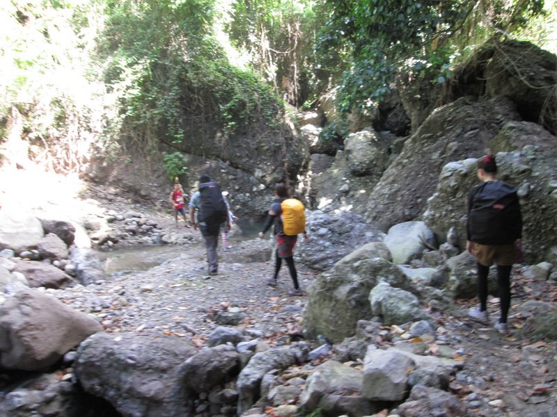
The first leg of the trail covers more vegetable gardens.  After 20 minutes, you’ll reach the beginning of the climb and the start of the Mossy Forest.  Like its namesake, the Mossy Forest is comprised of thick flora covered with moss.  It really is magical, like entering a whole different world.  The trail is safe and the footings are secured.  Regrettably, it was getting dark fast so we had no time to enjoy the forest.  Along the way, there are two water sources where one can refill.  The trail is not difficult for the experienced trekkers but maybe a bit of a challenge for beginners.  Remember to take a rest if your legs are tired, do not force yourself.  Take time to rest those ankles and stretch those muscles, sadly for us we had to keep moving.
Off to Mossy Forest

We continued through the dark trail with our flashlights, and as the night fell on us, so did the temperature.  A scarf is highly recommended, keep your nose and mouth moist and your neck warm.  It gets really dark in the Mossy Forest since no light can penetrate through it, don’t expect help from the moonlight either.

Finally we reached the camp site.  We knew we had to move fast, once we stopped walking our core temperature would drop quickly so we need the tents ready and food served before that happens.  Campfires are not allowed so make sure to bring portable burner for that much needed hot water for your hot beverages.  The temperature was near un-bearable; we choose not to cook the chicken because merely washing it can be painful.  Since it’s very cold, we figured the temperature would preserve the chicken until tomorrow.  We agreed to settle with rice and canned goods again before hitting the sheets- and we sure hoped we brought more!  The ground will be very cold, so make sure to bring insulators or end up hugging each other for warmth- like we did.

We woke up at 4:00 am, some of us hardly had any sleep because of the cold.  We had coffee and started on our way to the summit.  Felisi was very informative, providing us info and need-to-know about Mt. Pulag and the trail.  She said we should be able to get to the summit just before the sunrise, I know you’ve seen a lot of beautiful sunrise but I knew this one was gonna epic.

We reached the grassland where the altitude was too high for normal trees to grow on, so the hills are dominated by dwarf bamboos about 2 to 3 feet high.  It was still too dark to see what the view looks like, but I know this is nothing I would have seen before.  When we took our breaks, we would lie down and stare at the skies.  Even the view above is superb, the clearest night sky!  We were lucky that there were no clouds around since Mt. Pulag and the area is pretty much a rainforest- it attracts rain clouds.  Probably because of the altitude we were on, there was also that sensation that we were closer to the stars and the feeling of falling upwards.  Because of the clear sky, no dust, no smoke, no impurities- the slightest light disturbance can easily be noticed: shooting stars, and there were a lot.
Star-stary night

There are 4 summits in Mt. Pulag, Summit 1 is the highest and that’s where we are headed.  In the event of Summit 1 being too crowded, then the rest of can head to the other summits.  We finally reached the summit and the satisfaction of reaching the peak after all what we have been through was just the beginning.  We were relishing the pleasure of finishing our purpose and celebrating that achievement as a group with smiles and pictures and as much as we would love to shout at top of our lungs, it was forbidden.  Strictly no shouting as a sign of respect to the place makes sense to me.  It was still dark and we sat down and eagerly wait for the sunrise.
Eager for the sunrise

I was greatly mistaken when I said that the sunrise would be epic, it was…beyond words.  It would be an understatement to say that it did not look like the heavens opening, because it surely did look like it.  I could almost swear that gods of old would ride out the sunlight since this place is dubbed the playground of the gods.
Rising Sun

The longer I watched the sunrise, the more beautiful it became.  Then the greatest marvel revealed itself: we were standing on an island floating above a sea of clouds.  These “blow by blow by blow pleasure” has taken me to a whole new level of calmness, ecstasy, nirvana- then I knew I have changed.  This place made me a better man.
View from Summit 1


Natural High


Satisfaction guaranteed


Again I am struck by awe as I turn my head around, clouds everywhere- for a moment, we were gods.  The grassland stretches down to the camp site.  Peaks of neighboring mountains can be seen from Ifugao and Nueva Vizcaya as if they were within our reach.  We had to give ourselves some time to digest all these sensation.  Once we were back on our feet, we knew we had to conquer this moment and make it even more memorable, make it more…personal.
gods for a moment

Make the trip memorable: scandal in the clouds?

Before we headed back down, we made a pact to come back to this majestic place.
We will be back!
(Photo by Dale Demetrio Mariano)


Wednesday, February 6, 2013

Mt. Patong, Lobo, Batangas

What better way to start 2013 than a climb?  Batangas has been a favorite of mountaineers because of the wide array of trails available.  You can choose different trails to satisfy your day.  Last January, I had the opportunity to traverse Mt. Patong at Lobo, Batangas with SAGA Mountaineering Club.  The trail to Mt. Patong was under the “Minor Climb” category, don’t let that fool you.  This was the hardest climb I had so far.

Preparing for our climb at Nagtaluntong and getting ready for lunch
We were scheduled to meet up at Buendia Taft at around 5:00 am where we can ride the bus to Batangas... but as we all should know, what we really meant was 6:00 or 6:30.  We arrived at Balagtas, Batangas at 10:00 and took the jeep to Curba, Nagtaluntong where we picked up supplies at the local market.  We then had a quick lunch at a local carinderia and prepped for the climb.  Registration is required before climbing and a guide is ideal since this would be our first time.  Sir Jay was our guide; he is enlisted in the Philippine Army and based at Nagtaluntong.  We were very lucky to have someone from the armed forces for a guide, with him around, I felt like a VIP.


Walking along the fields, unknowing of the challenge that we face.
We started the walk- a long walk.  First we had to cross a stream so I had to buy myself slippers unless you’re ok with walking the rest of the trail with wet shoes.  Then we head to sir Jay’s kubo to change the footwear and start the ascend.

One of the many creeks we pass through.
The trail crosses streams and mostly under the shade of trees.  With the amount of shade and the cool weather, this trail was fine even for a day trek- a high-noon day trek.  The early part of the walk would cross fields to the foot of the mountain.  The rest of the climb was going through a set of roller-coaster assaults- one moment you’re going up, the next you’re headed down. 


When I mentioned that this is the toughest climb I have had so far, I meant we were catching our breath almost every 15 minutes.  Sir Jay – the military man that he is, started commenting on our frequent requests for stops and taking 5s.  “Sanay na sanay ka na sir, parang di ka pa pinag-papawisan.” I would comment to the army man at which he would reply with, “Pagod na nga rin ako sa pahinga nyo, eh.”

A view of the summit- almost within reach.


The primary resource around these parts is kopra/ copra.  You will encounter copra farmers carrying them down to the foot of the mountain.  You may also come across local hunters like we did.  The hunter shot a monkey from the other side of the mountain.  We were informed that most of these mountains are home to wild boars or baboy damo/ baboy ramo, dears, reptiles, and monkeys.  We passed through Aling Marisa’s house which is along the trail where you can take a rest, refill your trail water, and have a taste of fresh buko that they will harvest while you watch.


Thick vegetation can make a difference.

The final phase of the climb required some crawling under the thick vegetation of spines and thorns.  Some have steep slopes that required both hands and some had slippery angles with tricky foothold.  After almost 6 hours and one last struggle through the shrubbery, you will find yourself facing a whole new scenic view of distant clouds and mountains as far as the eye can see- you are standing next to a ravine!  At this moment, however, one would not mind the long fall down and instead one would enjoy the glamour of the sight of the mountains and relish the gushing cold wind of the hillside.  I turn my head to the east and to my surprise, I find the black cloth tied to a stick – a make-shift flag as it danced on the winds and satisfaction overflows when I realized- we reached the summit.

Sir Jay assisting the rest as we approach the summit.

We pitched our tents and started to prepare for supper.  Our chef, Gian was in-charge of the culinary while we started to… get wet!  As the night dawned down on us, so did the weather.  Dark clouds started to gather above us and before we knew it, it started to drizzle.  As if the cold wind was not enough, it had to rain.  It was not expected, and it was my fault not being ready for this- I did not have insulation for my tent and so the flooring got wet, real wet.


The first view after the thick shrub obstacle course.
It was no use, we were getting wet fast, and I was getting cold faster.  While we wait for Gian’s pork sinigang, the rest of us decided to start the one thing that can possibly be the key to our survival- Gin!  We were required to bring one bottle each, but ended up with just 2 GSM blue and 1 GSM kuwatro-kantos to be shared around 8 heads.  There was no where to settle down for the drinks, the grasses were wet, we can not rest our butts on wet surface as that would increase the possibility of our body temperatures dropping.  What to do? – we downed them GSMs while standing, something you might be familiar with manong tambays over there, but let me tell you- it was no fun! We had to take it down fast with shots, in 10 minutes 1 bottle was empty and one fellow was dizzy!  After we had our dinner, I headed to my wet tent and tried my best to fall asleep- though my buddies didn’t make that easy for me, right Harvey? Vann?

The cliff opposite the campsite at the summit.
Isla Verde
Nagtaluntong


In the morning, nothing beats waking up and stretching at the peak- instead of stretching and looking up, you stretch and look at the land below!  Sipping down hot coffee while watching the clouds creep through the mountain peaks at the horizon.

The team leaving the summit, another peak conquered.


Tuesday, February 5, 2013

Banaue Rice Terraces

It has been 20 years since I last foot step in my mother’s home province, Banaue.  December 2012, I had the chance to visit the stairs to the skies.  It is a good 8 hour trip from Baguio via Nueva Vizcaya. Taking a trip here is like taking a trip back in time.  The smell of the air, the coldness of the weather, the culture, the people, and the food…the place- they take you back to an almost tranquil satisfaction.  If you are looking for adventure, fun, adrenaline rush, then this is not the place for you- at least I wouldn’t recommend it.  This would be a place to revitalize, relax, rest, and be reinvigorated- in short, I loved sleeping most of the time I was here.  The place is peaceful, so quiet and the weather so appealing for often siestas.  Sip a cup of their brewed black coffee and just watch the fabled Rice Terraces from the window- contentment at its simplest.
 
Having cofee by the window overlooking a great view of the terraces.
  
  
A trip anywhere would not be complete if you do not visit their local market.  I love visiting these places everywhere I go, if you want to see culture and current events then visit the local markets.  Since the debut of society, the marketplace has always been the real center of civilization.  Here you will see the crafts and trades of the locals.  This is where I recommend having a meal as well, all the time there will be a food establishment around the area, and here you can have a good local gastronomic experience.  


Dinner with the family enjoyed over the pinoy family-themed adobo.

For tourists or backpackers on the move and expect to do a lot in a short span of time while visiting Banaue, I recommend eating at the local carinderias or turo-turo’s.  The restaurants, breakfasts, or inns take half an hour or more to prepare their meals, so if you have plans to cover a lot of places, then refrain from eating from the above.  In the evening, don’t expect turo-turo’s to be still open late since most of them close early.  It is best to get lodging that allows you to cook and use the kitchen. 


Early morning, don't get up yet- bed is good...zzzZZZ

To experience the best views of the Rice Terraces, try to get to the viewing points before noon.  A lot of tourists flock to the view points after or during lunch.  Also, there is a bit more chance that the visibility of the terraces would be blocked by fog in the afternoon, so be there early but not too that you catch the morning mist.


Visit the local museum if you have the chance, there are so many to learn- even for local folks.
 
Always something new to learn in the museum.
 
Backpacking with my mom.

After 20 years, the land has changed and so did the people.  The Rice Terraces lost a bit of its charm, more houses and new structures have been erected in the once green scenic views.  The fields themselves look a bit dull, the magic maybe slipping away.  This is probably because not a lot are tending to these once dubbed as the “Eighth Wonder of the World”.  The new generation of locals have moved on like the times, instead of working on the fields and terraces, they have found new source of income in other industries and thus, the Rice Terraces is left unattended to and only time can tell if it would wither and die a painful death and only be remembered in literature at the backs of elementary textbooks.

Saturday, May 26, 2012

My first Trek: Anawangin Cove Via Mt. Pundaquit (March 31- April 2, 2012)


I grew up from Baguio.  I always enjoyed walking on grassy plains shielded by the pine trees from the sun.  It has been so long since I last had a great walk!  I used to walk hours and hours across hills back at the highlands, and I miss it so.  The cold wind blowing through the hillside, listening and feeling it on top a ravine, and standing at the peak where the wind blows from one side with so much power and all its marvel; while on the other side of the summit, the air is as peaceful as a melody.  So I started looking around for a way to feel that again!  I talked to my friends and asked who would like to experience how it felt to walk hours and hours up a mountain- who wants to trek!   My friend Peter decided to tag along and he was as excited as I was.  We looked for others who have the experience who can guide us on the right trail to get to the top and succeed in this expedition.  After days of looking around the net, we we’re able to get in touch with one of Peter’s old colleague and friend, Denz.

Denz welcomed us to join their next trek with their group, TripPeros Mountaineering Club.  We were so glad and so excited!  The route would be from San Antonio to Anawangin Cove via Mt. Pundaquit, and based on our schedule, it’s going to be a night trek!  Then we camp at Anawangin Cove and enjoy the beach!  My girlfriend and I started our preparations for the trip.  We would need lights for the night trek and the camp, a tent, trekking shoes, and a backpack.  We were told that the trail is on a beginner’s level and is rated as a number 2 from a 1 to 10 difficulty, 10 being the most difficult.  It’s good that we were able to join an easy path campaign, I was not ready for anything more than that!  Our gear was nothing special: regular sneakers, denim shorts, casual shirt, travel backpack, dome tent, and rechargeable lamp.
We arrive at San Antonio and prepare

We take the San Antonio bus via Olongapo City from Cubao at 3pm.  It takes an almost 6 hour ride to San Antonio where we are joined by our local guides.  We take the tricycle to the starting point of the trail where we take final measures and double-check our equipment.  We are guided by local trailblazer Manong Tony.  We have a moment of prayer before we go forth to the dark hills.
Everyone's geared-up and ready to go!

The first few minutes of the trail is just composed of a dirt road: grass, sand, and dirt.  As the minutes pass by walking, laughing, changing stories- the night gets deeper, the darkness seem to grow, it’s like the more we walked, the less light there was.  Then not long after, we hit the end of the dirt road.  The previous laughter and humor has faded, we knew it gets serious from here.  We reach our first stream and take a few minutes rest.   I am already sweating through my shirt, and it has just been half an hour.  I wash my face on the running water and we move on.  Our trail leads to shrubs, trees, and dried river beds.  We need to keep up and pace with the rest of the group or we may get lost.  The more we walk, the danger gets serious.
Some of the lights in our group have failed or ran out of batteries.  We had to share the lamps, and this makes things more complicated.  We had to position the lights so that everyone can see the trail, these are the times when you just wished you brought more lights.  The longer we walked, the farther we reached, the less light we had, the more complicated the trail becomes.  We soon reached a hillside, I am not certain how we got there but we have reached the windbreaker side of the hill.  Strong winds blow against the bushes, trees, and us.  The wind cooling our bodies down helps us revitalize for the big one- the long stretch to the summit!
The first few stops were fine
The trail leads to higher grounds, and the more we climb, the more I feel my legs ache.  It is each trekker’s worst nightmare- my legs are starting to numb.  Tired and exhausted, we take a rest every time we get the chance.  When we start to climb again, we climb and nothing else- not even a word spoken.  When we need to rest, we pat the group member in front of us to signal that in front of them to let them know we need to take a break.  When we take our breaks, again we speak less.  We take those precious seconds to psyche up.  There is nothing more we can do about our weary bodies, we can drink all the water we can but that will not make a difference, it is all up to the mind now.  We continue our advance to the summit, Denz and his brother, Johnny would try to cheer us up and keep our guts.  Every so often, they would try to remind us that the summit is just a few more meters away.   This is when I figured out, the summit is really just a few more meters away! Above!


Our bodies are close to giving up, we take a couple more stops on the way


We are worn-out!  I have never been so tired in my whole life!  I think I sprained my thigh, it hurts like hell when I try raising it too high.  I must have strained it on one of those steep paths we passed earlier.  My balance is also starting to get dull, but I must maintain focus.  At this rate, I may not be able to get to the summit, or even if I do- reaching the summit is just half of the trail, we also need to head down to the base of the mountain to get to camp.  Peter and my girlfriend Kat are also very drained, but I can’t let Kat and the others see me giving up.  I stand and walk, I want to feel the winds at the peak, I want to push myself to the limit, I want to reach the summit! 

We have been walking for almost three hours uphill this dark trail.  It may have been a level two trail, but add the absence of light and it becomes more of a level seven to me.  One wrong turn and I can head tumbling down to whatever unseen bottom there is down the slope there, we are technically in a ravine.  My leg is failing me; sometimes it does not move how I want it too.  Then light from above blinded me, “We are here!” the lead guys cried out to us. I am aggravated and agitated!  We gave it one last burst!  The wind started to blow wildly uphill as if carrying us to its crowning glory.  We finally got to a flat surface, I bend down tired, my hands on my shaking knees.  I slowly raise my head, stood straight, and yelled on the top of my lungs!  I am not sure what I shouted that moment; I think I blanked out for a moment when I realized I was finally at the summit.
At the top, baby!
This is what it would have looked like if the sun was up.

We took about 20 minutes to enjoy the summit and the satisfaction of finally reaching it, took our pictures, sat down and wondered how we got there, hard to believe that we are capable of such feat.  There I felt it: The cold wind blowing through the hillside, listening and feeling it on top a ravine, and standing at the peak where the wind blows from one side with so much power and all its marvel; while on the other side of the summit, the air is as peaceful as a melody.  Then after we had our time enjoying the summit, we head down the mountain through the trail on the opposite side of the hill.  The trail down was steep, but it was a lot easier going down than climbing up.

The way down was different from the trail up.  It was mostly a rocky slope; some have unstable grounds so we have to be very careful with our footing.  It took us just an hour to get down the mountain, although it still was tiring.  Some of our fellow trekkers got mild injuries on the way down like bruises, cuts, or grazes.  Good thing they brought first-aid kits.  Soon we were on flat ground, a few minute walk to the camp.  Along the way, we passed a dried-up riverbed where local Tamaraws or water buffalos were resting under the shadows of the trees and bushes.  We need to be swift and quiet, we do not want to get their attention that may startle the beasts, last thing we needed was a stampede and we would not have a chance to outrun them with our large bags and tired bodies.
A new day, a new adventure.  Fresh pine breeze by the beach.

When we got to the camp, everyone was exhausted. It was 4am, I setup our tent right away and got ready to rest while some of us still had the energy to party!  My energy reserves are dried up, I’ll party after I get some rest.  After 3 hours, I crawled out the tent to find the other trekkers still at it on the bottles!  These people are like energizer bunnies, they just keep on going and going!  We had breakfast, they offered sinigang which they cooked for us and was supposed to be for our welcome dinner but turned out we had a different schedule.  After breakfast, we head out to the beach.  Anawangin Cove’s beach has black sand which was actually from volcanic ashes from Mt. Pinatubo when it erupted more than a decade ago.  Instead of coconut trees, Pine trees cover the cove!  This brings out a fresh cold breeze unlike the other usual beaches.  The water here has a sudden depth when the tide is high, when the tide is low, you can walk along the shallow waters.

Ma'am Jo chilling under the pine trees.
Perfect weather at the cove.
Anawangin Cove
Sunsets by the beach are beauties.

Make sure to bring all that you need when you get to the cove, food, water, fuel, or light.  The only way to get supplies would be to go back to the nearest market via boat.  There are small stores at the cove where you can purchase canned goods, instant noodles, water, ice, alcoholic drinks and the likes but up to twice the normal cost.  If you get tired of swimming or baking under the sun, you can try checking out the lagoon, it’s a nice spot to take pictures of the place, the pine trees look magnificent above the water.  There are multiple outdoor baths and comfort rooms where you can wash after swimming.  When the sun gets too intense, it’s best to spend time under the pine trees.  There are locals who sell hammocks that you can tie between the trees and pass the time reading a book or just siesta the afternoon away.
Let the merrymaking, begin!
Denz asking Peter to do a double-shot (simultaneous shots of gin and beer)
And there's more!
Look how many bottles we downed! Hardcore!
In the evening, make sure you have plenty of light.  It gets really dark, especially since the pine trees can cover moon light so either light up your lamps or get that fire going.  They sell firewood at the cove, too so make sure to stack some.  When you’re in a place situated far from civilization, the best food is always the grill!  Nothing beats grilling or barbecue when we Filipinos are out.  When dinner is done, what do you expect, desert?  Nope!  The boys are getting ready for another round of night partying!  These trekkers are hard to the core, tough inside out!  They keep up with the bottles, even the girls can hold their liquor really good!  Tonight we party hard, because tomorrow, we have to get back to our real lives waiting for us here at the metro.
Anawangin's mysterious cove.
As we ride the boat back to Pundaquit beach, we pass along islets and black marble islands, and from the horizon, Mt. Pundaquit which is so much beautiful after we conquered it.